Skip to content

Preliminary Framework Plan

Explore the poster board presentation of the preliminary Framework Plan, highlighting core ideas and strategies for shaping the future development of the university.

Guilding Principles
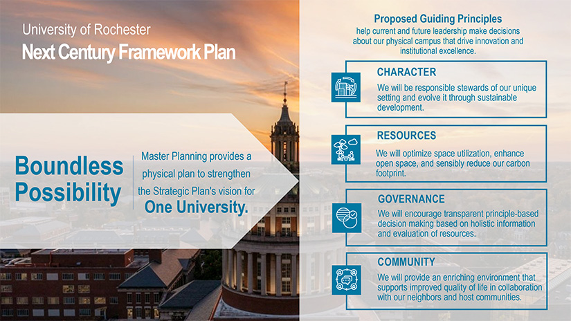
While the primary purpose of the master plan is to provide a vision for the future physical development of the University’s campuses, it hopes to further support this development by bolstering a transparent data-informed decision-making process. Principles are a key tool in this regard, as they provide substantive evaluative criteria that university leaders can consult when considering new capital investment opportunities.


A series of four aerial graphic renderings depicting the growth and placement of buildings across the River Campus and Medical Center from the 1920s to present.
Campus History
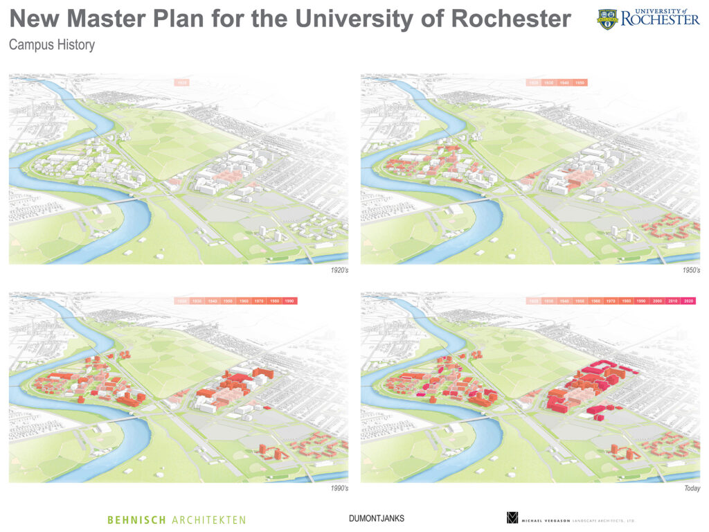
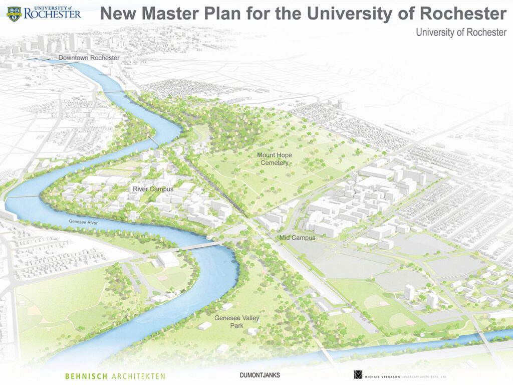
Originally, the River Campus was organized around a clear idea of quadrangles and buildings. In contrast, the clinical needs of the Medical Center drove a dense interconnected development pattern. Historically, the two campuses have developed independently. We now have an opportunity to create a more connected environment in support of One University.


An architectural map of River Campus and the Medical Center highlights the potential for a transit spine running down Intercampus Drive; four GIS maps display walking, bus and transit routes identified in the campus co-mapping activity, also highlights the central importance of Intercampus Drive.
Framework Plan – Preliminary Design Direction
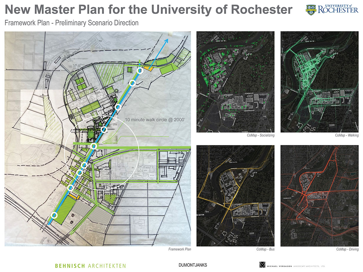
The emerging master plan vision centers on a connected campus that uses Intercampus Drive as a transit spine to quickly connect different zones and add value to underdeveloped parcels, including the potential creation of a new research and innovation zone that ties the River Campus and Medical Center together.


A series of four architectural maps of River Campus and the Medical Center depicting four associated core ideas: 1) Initial Framework One Campus, a) implement an inter-campus transit and pedestrian corridor, b) becomes the main street of the one campus idea; 2) Landscape Framework, a) Complementing the campus river connection idea is a system of quadrangles, linear pedestrian preserves, internal courtyards, and green streets around which future building should occur, b) these spaces should serve an innovative stormwater function whenever possible, c) similar to our traditional quadrangles on campus, new spaces and streets should have strong tree canopies that define them, d) where strategic, open view and access windows to the rivers edge; 3) Academic and Research As One Campus: Civic Idea, a) define a bold and clear open space and circulation framework to guide new campus district development, b) re-energize and transform existing space whenever possible and prudent, c) transit idea will enhance academic proximities; 4) Mobility, a) propose bold transit street identity idea to achieve the One Campus idea, b) use streets and pedestrian corridors in mid-campus to organize the district into clear, implementable, and phased streets and development blocks, c) do Crittenden Boulevard, Lattimore Road, and Westmoreland Drive extensions tie into the proposed intercampus transit street?, d) organize phased replacement parking garages along the transit street and along the south edge of the district near the recreation fields to achieve 5 – 10 minute walk distances in the research district and be adjacent to the proposed intercampus transit line, e) propose strong pedestrian street crossing environment, f) propose clear wayfinding and signage environment.
Framework Plan – Preliminary Scenario Direction
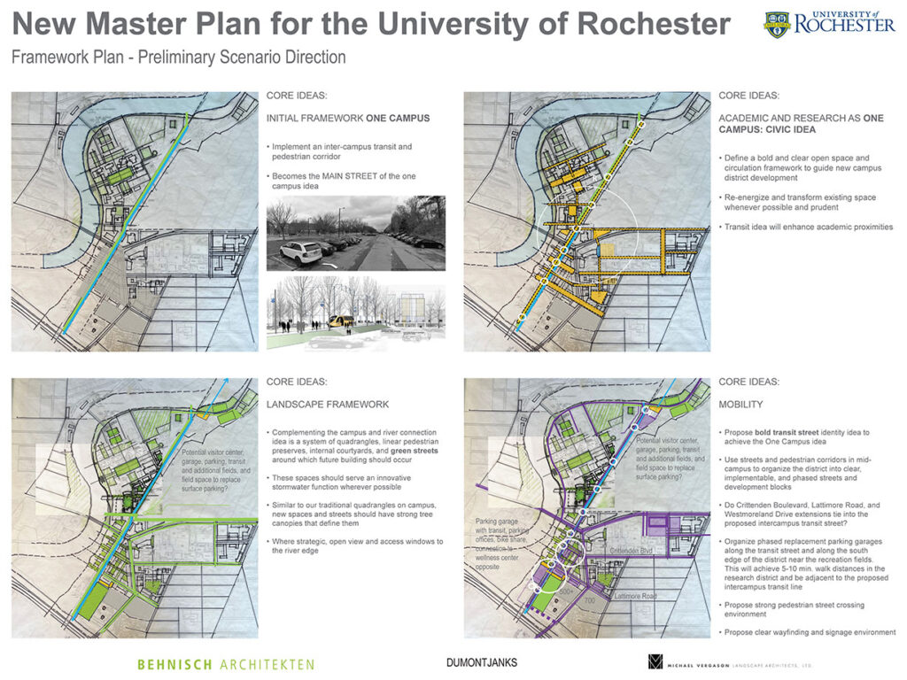
As the master plan continues to develop, it will be multi-faceted, integrating topics like mobility, land use, landscape, future building sites, renovation strategies, etc., providing the university with a holistic toolset to support future capital investment.


Graphic rendering illustrating potential points for creating visual and pedestrian pathways to the riverfront at three locations north, mid and south of campus with associated photos of each location point.
Connection to Genesee River
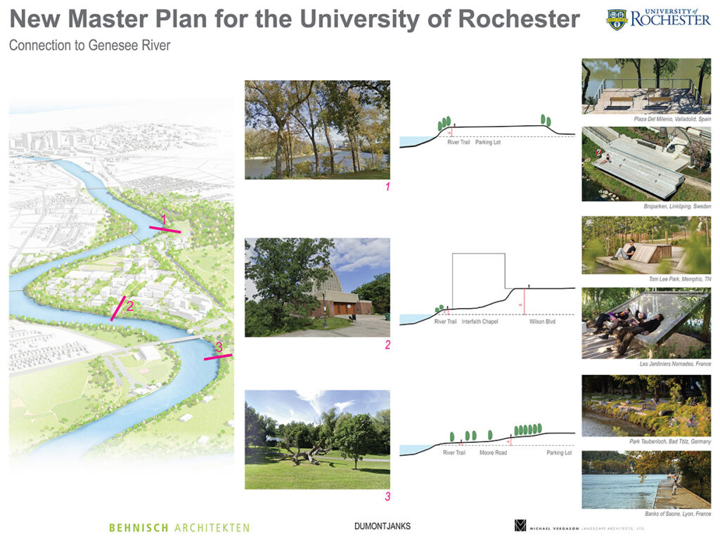
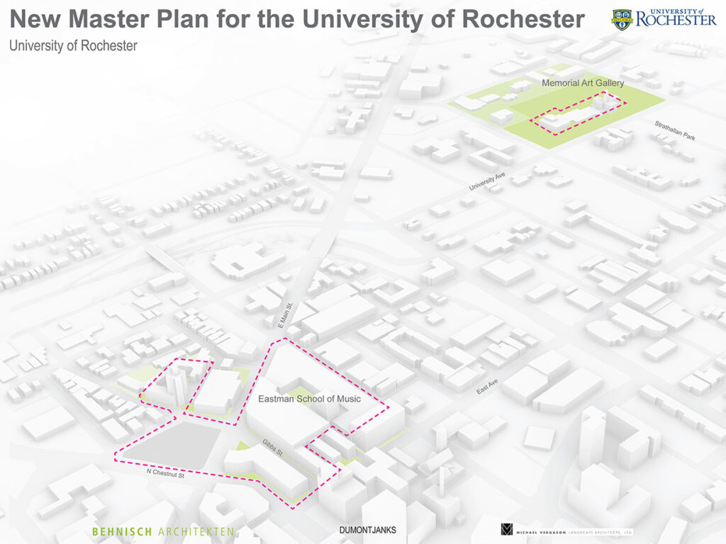
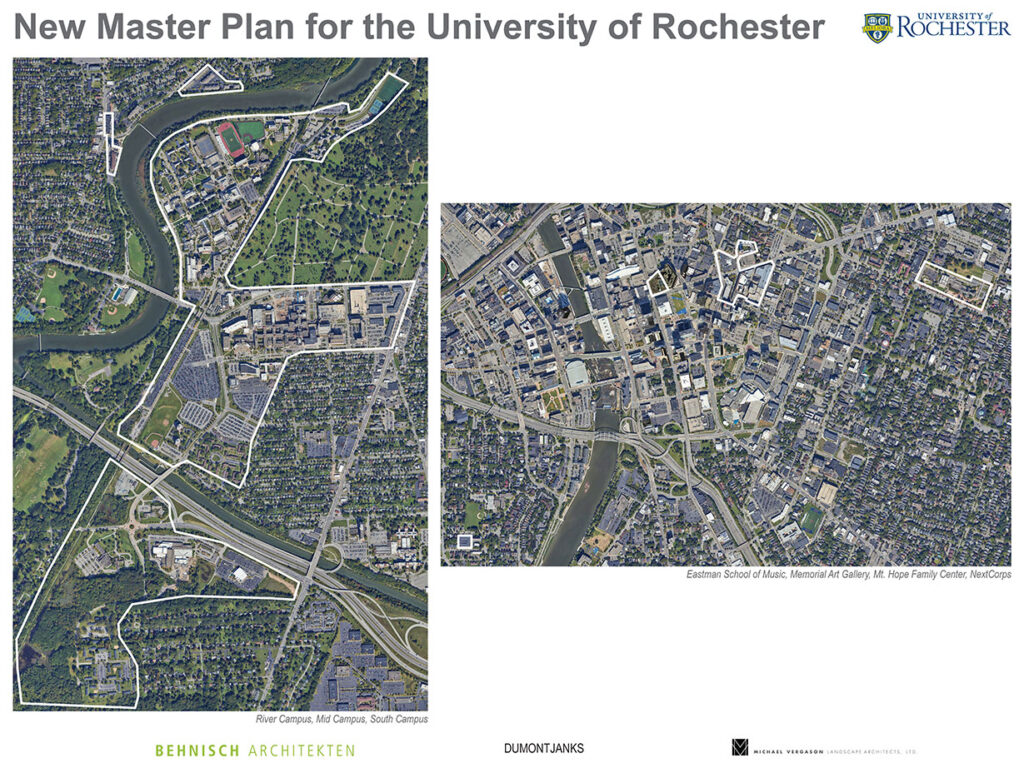
The Genesee River is a wonderful asset, and the master plan will seek to strengthen connections between the campus and the river.


Graphic rendering illustrating the footprints of the Memorial Art Gallery and the Eastman School of Music.
The master plan is intended to be comprehensive and will consider all university campuses, including the university’s important downtown presence.


Satellite imagery of the River Campus, Medical Center, Eastman School of Music and Memorial Art Gallery and surrounding downtown area.
Satellite Imagery Both Campuses (Reference)


Graphic rendering of the current River Campus and Medical Center from the Genesee Valley Park to Downtown Rochester.
River Campus (Reference)